Victor Marotta

Hi, I'm Victor Marotta

Surveying & Cartographic Engineer · Founder of Territorial · Technologist at IBGE

I'm a surveying and cartographic engineer who builds geospatial software. Through Territorial, the engineering consultancy I founded, I lead a team of developers delivering production platforms for companies whose work depends on spatial data: processing pipelines, backend orchestration, and the web, desktop and mobile clients on top of them. My role in each engagement spans architecture and development, consulting and technical leadership.

I also work at IBGE, Brazil's national statistics and mapping institute, as a Geographic and Statistical Information Technologist.

I hold a degree in Surveying and Cartographic Engineering and a master's in Civil Engineering focused on spatial databases and GIS, both from the Universidade Federal de Viçosa, and I've published on cadastral data modelling, PostGIS-based land registries and UAV-based structural monitoring. Before Territorial, I led cadastral projects and GIS product development at engineering companies in Brazil.

Most of what I build now runs on infrastructure I also wrote: Ordo for orchestration, Sentinel for monitoring, and the tooling that runs Territorial itself. New engagements go through Territorial.

What I do

Four areas I work across on every platform, from the data model to the deploy.

Geospatial data platforms

Spatial databases and cadastral data models, and the processing pipelines that turn imagery, LiDAR and bathymetry into products people can open in a browser.

  • PostGIS
  • GDAL / PDAL
  • GeoServer
  • QGIS
  • LADM
  • Entwine / Potree
  • Photogrammetry

Backend & orchestration

APIs and job orchestration for long-running processing: validated contracts between steps, queues, artifacts and state you can query when something goes wrong.

  • TypeScript / Node.js
  • Python / FastAPI
  • PostgreSQL
  • n8n
  • Ordo
  • MCP

Web, desktop & mobile clients

Map-centric interfaces that non-GIS users can operate, from operations dashboards and 3D viewers to offline field apps.

  • React / Next.js
  • MapLibre / OpenLayers
  • Cesium / Potree
  • Ionic
  • Tailwind CSS

Infrastructure & operations

Deployment, monitoring and documentation for platforms that have to stay up: containers, Kubernetes, edge delivery and synthetic tests that catch stale data before a client does.

  • Docker
  • Kubernetes
  • Argo Workflows
  • Cloudflare
  • GitOps
  • Sentinel

Selected work

Client platforms, Territorial products and the tools I built to run my own practice. Each page has a short summary for fast readers and a longer account of the engineering.

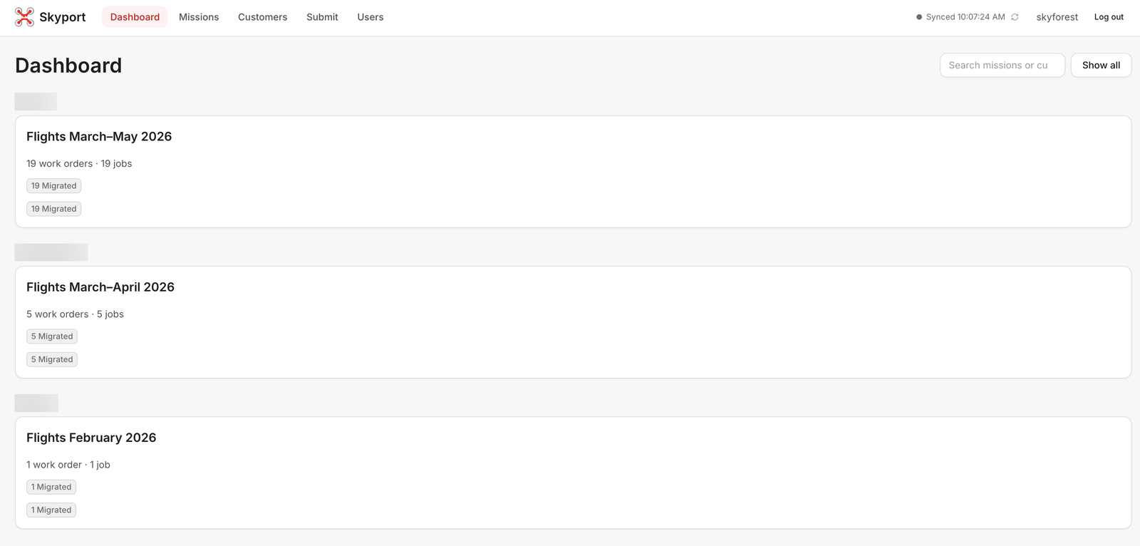
Dashboard grouping missions and work orders by customer
Client platformSkyforest

Skyport

The operations platform that turns Skyforest's drone flights into finished map layers, end to end.

  • n8n
  • Ordo
  • Next.js
  • MapLibre
  • +6
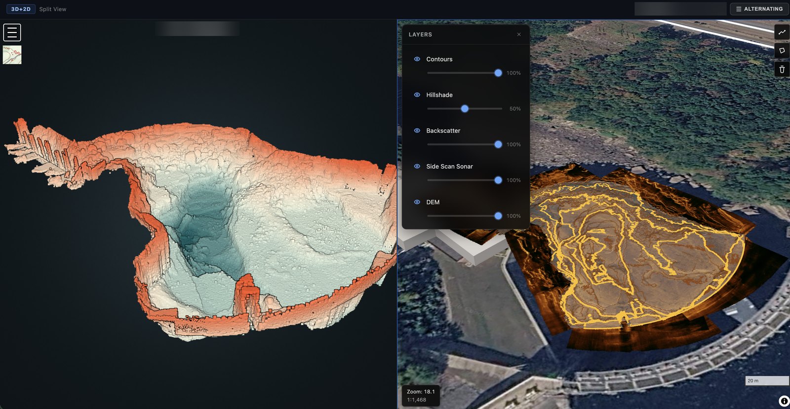
3D bathymetric point cloud next to a 2D map with contours, hillshade, backscatter and side-scan sonar layers
Client platformUAI

MapPrism

A LiDAR and bathymetry processing platform that turns raw point clouds into web-ready 3D and 2D products automatically.

  • Ordo
  • n8n
  • PDAL
  • GDAL
  • +7
  1. Weather providers
  2. Argo Workflows
  3. Storage
  4. Edge Workers
  5. Weather map & clients
Platform teamJane's Weather / ACM

Weather-Data Platform

Lead engineer for Jane's Weather, an Australian weather-data platform now part of ACM: from building its weather map to running the whole platform with the Territorial team.

  • React
  • MapLibre
  • PMTiles
  • Python
  • +10
  1. Client
  2. Ordo
  3. n8n workers
  4. Object storage
  5. Finalizer
Territorial product

Ordo

A contract-driven orchestration control plane for long-running processing jobs, built to sit above n8n.

  • TypeScript
  • Node.js
  • Express
  • PostgreSQL
  • +3
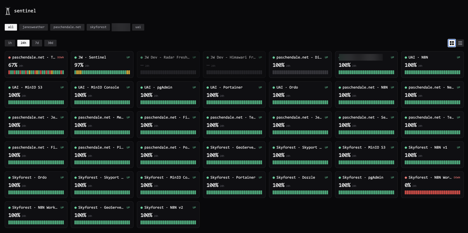
Status grid across every environment Sentinel watches, filtered by tag
Territorial product

Sentinel

A programmable synthetic-monitoring platform: tests as JavaScript, alerts on state change, public status pages, on a 1 GB VPS.

  • TypeScript
  • Fastify
  • Next.js
  • PostgreSQL
  • +6
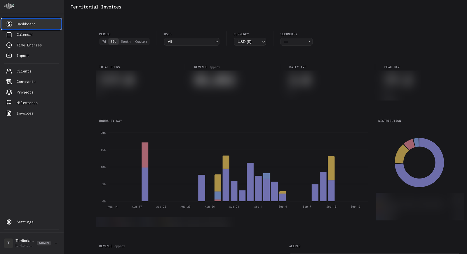
Dashboard: hours, revenue, daily distribution by client and alerts
Territorial product

Territorial Invoices

The system that runs Territorial's billing: calendar-based time tracking, contracts with deterministic billing math, and invoices generated in minutes.

  • Next.js
  • Fastify
  • Prisma
  • PostgreSQL
  • +4
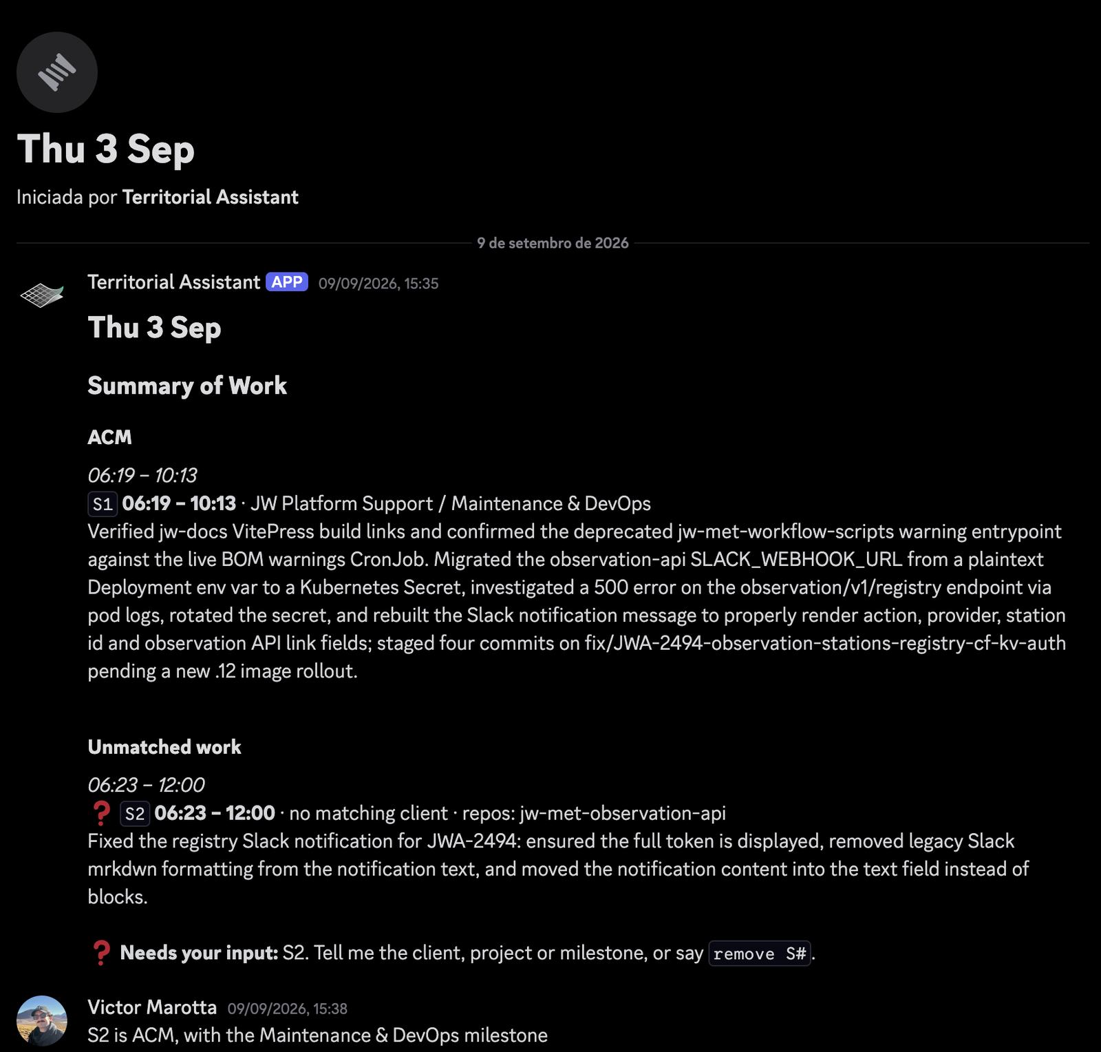
Daily proposal in Discord: sessions per client, unmatched work flagged, plain-English correction
Personal R&D

Territorial Assistant

A Discord-based daemon that turns my own work activity into approved timesheets and a curated knowledge base of engineering stories.

  • TypeScript
  • discord.js
  • Drizzle
  • PostgreSQL
  • +3
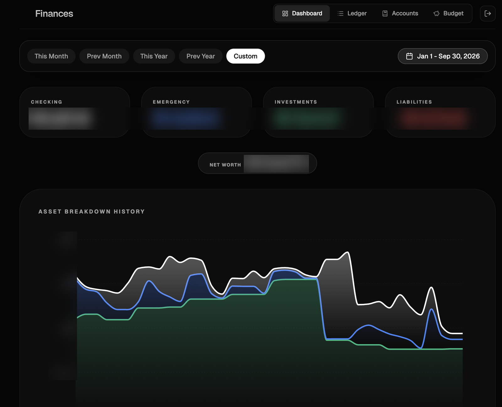
Dashboard with account groups, net worth and asset-breakdown history
Personal R&D

Finances

A personal ledger and budgeting app with a Postgres-first architecture: one PostgREST instance, a static frontend, nothing else.

  • PostgreSQL
  • PostgREST
  • React
  • Vite
  • +5
  1. Question
  2. LLM
  3. Validation
  4. PostGIS
  5. Answer
Client platform

Natural-Language Geospatial Query Platform

A product where users ask questions about geographic data in plain English and get answers, charts and maps back, generated by an LLM over PostGIS.

  • FastAPI
  • Python
  • LangChain
  • PostgreSQL
  • +7
Geo360 cadastral interface
Client platformTopocart

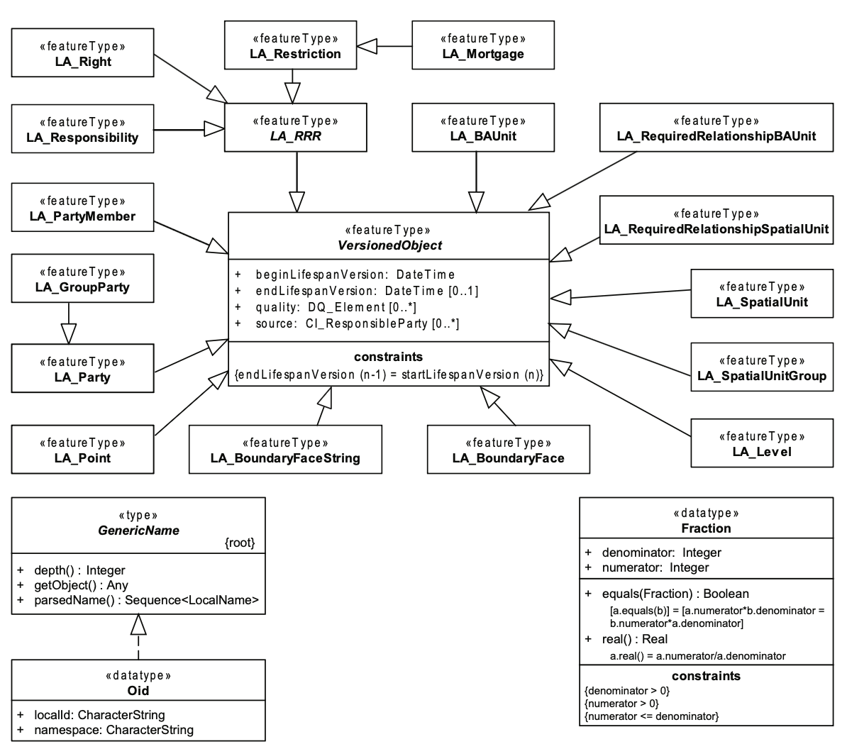
Geo360 LADM

The first land administration system in Brazil built on the ISO 19152 LADM standard, led while I was at Topocart.

  • PostgreSQL
  • PostGIS
  • GeoServer
  • LADM (ISO 19152)
  • +4
Dragonfly GeoAnalytics
Client platform

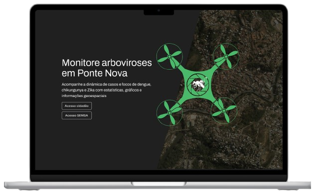
Dragonfly GeoAnalytics

A geointelligence platform that helps municipalities fight dengue, Zika and chikungunya with drone imagery and case mapping.

  • React
  • Mapbox
  • Highcharts
  • Express
  • +6
GeoServer Mobile Client
Client platform

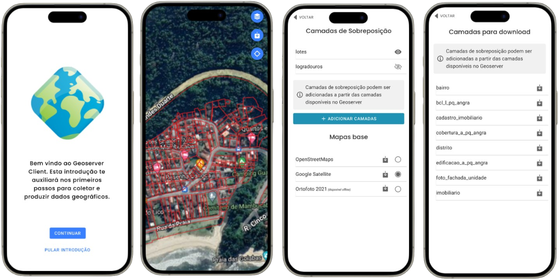
GeoServer Mobile Client

An offline-capable mobile client for GeoServer layers: download, view, edit features and export, built in three weeks.

  • Ionic
  • React
  • TypeScript
  • OpenLayers
  • +2
Territorial Maps
Territorial product

Territorial Maps

A SaaS for publishing drone imagery: upload from your computer, get web-ready layers and share instructions for any GIS.

  • Next.js
  • MapLibre
  • Cloudflare
  • n8n
  • +3
Point Cloud Publishing Automation
Territorial product

Point Cloud Publishing Automation

An n8n-based framework that takes raw point clouds to optimised Potree scenes, built as the backend of a SaaS.

  • n8n
  • PDAL
  • Entwine
  • PotreeConverter
  • +3
Geoportal Itabirito
Client platformItabirito

Geoportal Itabirito

A public WebGIS that consolidates the multipurpose territorial cadastre of Itabirito, Minas Gerais, into one map.

  • React
  • TypeScript
  • OpenLayers
  • QGIS Server
  • +1
  1. Draw a line
  2. API route
  3. PostGIS
  4. Profile
Personal R&D

Slope

Draw a line on a map and get a live elevation profile computed straight from a PostGIS raster.

  • Next.js
  • React
  • rlayers (OpenLayers)
  • Plotly
  • +3

Experience

  1. Founder & Lead Engineer · Territorial

    2024 – present

    Geospatial engineering consultancy. I lead a team of developers delivering platforms end to end for clients in Sweden, Australia, the US and Brazil, from architecture and development to DevOps, consulting and technical leadership.

  2. Geographic and Statistical Information Technologist · IBGE — Instituto Brasileiro de Geografia e Estatística

    2025 – present

    Brazil's national statistics and mapping institute.

  3. Requirements Analyst → Technical Coordinator · Topocart Topografia, Engenharia e Aerolevantamentos

    2022 – 2025

    Technical lead for GIS products, including Geo360 LADM, the first LADM-compliant land administration system in Brazil. Later coordinated the software team.

  4. Geotechnology Consultant · ENGEFOTO Engenharia e Aerolevantamentos

    2022

    Cadastral (CTM) projects in Nova Serrana, Itabira and União da Vitória: collection methodology, PostgreSQL/PostGIS schemas, QField/QGIS/PyQGIS tooling, quality control and team training.

  5. Geotechnology Consultant · COPGEO — Engenharia e Consultoria

    2021 – 2022

    Web geointelligence platforms (GeoServer, PostGIS, Node.js) and cartographic quality control per ET-CQDG and NBR 13.133, including GNSS processing and cadastral reference networks.

  6. Intern → Researcher → Project Manager · GENTE — Grupo de Engenharia Territorial (UFV)

    2017 – 2023

    Research on multipurpose cadastre data models, WebGIS and spatial data infrastructure; led office and field teams on CTM programs in three municipalities, including UAV photogrammetry and cadastral reference networks.

Full résumé

Latest from the blog

All posts

Get in touch

For projects and consulting, reach me through Territorial or by email.